


bastide bleymard

bruno38
User
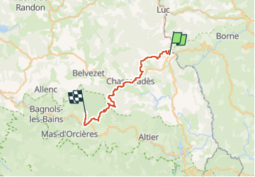

Length
32 km

Max alt
1412 m

Uphill gradient
1066 m
Km-Effort
45 km

Min alt
1017 m

Downhill gradient
852 m
Boucle
No
Creation date :
2022-04-25 06:07:55.845
Updated on :
2022-04-25 14:17:55.306
7h22
Difficulty : Very difficult

FREE GPS app for hiking
 SityTrail
IGN / Geographical institutes
SityTrail Plus
The world is yours!
About
Trail Walking of 32 km to be discovered at Occitania, Lozère, La Bastide-Puylaurent. This trail is proposed by bruno38.
Positioning
Country:
France
Region :
Occitania
Department/Province :
Lozère
Municipality :
La Bastide-Puylaurent
Location:
Unknown
Start:(Dec)
Start:(UTM)
571732 ; 4937712 (31T) N.
Comments